Tuesday, June 30, 2015

Port Hartley 6-20-15 to Baker Inlet


Our journey is moving into less and less populated areas and the scenery remains outstanding.  A quiet anchorage behind Promise Island.


We had been off line for a few days so went around the corner to Hartley Bay, a native community reported to have cell and net service.  The small harbor was well kept and very protected.  Full coverage on cell and 4G internet.   It was a Sunday so the community was very quiet but we took a walk around and found lots of new houses under construction.


 The entire town is built over a peat bog and the roads are all in the form of boardwalks.  Houses are built on pilings.   Many of the new homes are replacements for older homes overwhelmed by mold.


Heading into Greenville Channel on a flood tide we enjoyed about 1 to 2 kts of push most of the way to Baker Inlet.   Winds picked up in the afternoon and Greenville Channel can get rough when the wind and the tide oppose each other.   Just as the wind came up the tide changed to ebb and ran with the wind.  


Displaying IMG_0699.PNG


The route is a major path to Alaska and commercial traffic makes use of this protected inside passage.  This is one of BC's low wake ferries.  She was making about 18 kts with very little disturbance.


Entering Baker Inlet requires faith in charts and a call on VHF to warn any outbound vessels of your approach to the blind corner surrounded by trees. Once inside the lagoon opens up and plenty of room to anchor with only one other boat that evening.  

We are getting better at rainy operations, well everyone but Keela.


Box Score 7 hours   24 gallons 52 miles  


Tuesday, June 23, 2015

Culpepper Lagoon 6/17-6/20/2015

Culpepper Lagoon       6/17-6/20/15     

Continuing north Culpepper Lagoon is a “NOT TO MISS” according to the guide books and Active Captain recommendations.    This arm is surrounded by vertical peaks near 3000 ft tall, covered in tress growing at impossible angles.  Waterfalls along with shear rock walls too numerous to count.  The lagoon is located at the head of Kynoch Inlet.  All part of the Fjordland Recreational Reserve. 
Words won’t do justice to the scenery and the solitude.  We arrived to find Indigo, a fellow trawler traveler on a Selene 48 anchored.   Last saw them at Tribune Bay.   They reported good crabbing and we found the same.  Caught about a dozen over the next two days, several large enough for a meal each.   No luck on Salmon yet but will keep trying.


 It rained, sunshine, rained, sunshine several times each day.  Often just a drizzle but then a steady stream for half an hour or so.   Very little wind so it was comfortable to be in the rain with good raingear. 

The lagoon is separated from the inlet by a narrow area that can have currents as high as 12 kts.  We entered an hour before low water slack in the dinghy on an estimated 4 kts.  A few small whirlpools and lots of turbulence.  The entrance narrows to about 60’ wide and many take larger boats inside.  I’m to conservative to risk it.  The area is so remote we have heard no radio traffic since we got here and often loose GPS due to the steepness of the surrounding peaks.   Exiting the same area 45 minutes later it was as still as a mill pond.   We met a Canadian Coast Guard small boat dispatched from a larger (100 ft) patrol boat.   Friendly as ever the Guardsmen wished us well and inquired on the crabbing status. 


Just don’t have the writing skills to do justice to the scenery so will let these pictures tell the story.  


Mary and Keela found a good way to stay warm on the dinghy ride.


BOX SCORE 7 Hours 21 Gallons 53 Miles 

Monday, June 22, 2015

Codville Lagoon and Shearwater 6/17/2015


Arrival at this secluded spot required a run thru a narrow opening to a wide lagoon complete with its own island.  We anchored in about 40’ on a rocky bottom in one corner of the lagoon, just in front of a trail sign.   The trail leads to a freshwater lake about half a mile away.  Over the years someone has hauled lumber to the site and made a walkway up and over the ridge to the lake.  It’s a great hike and made much simpler by the boardwalk.   It’s a lot of boards.  Can only imagine the work to get them there, cut them, place them and maintain it.   Rumor is its all volunteer work. 


The result of the work is a path suitable for most anyone.  A few pretty steep spots but very worth the effort.


My guess is the lake is nearly 100 acres and its set in a valley with high mountains on one side and trees on the other.   One of the quietest places we have been, no trace of mankind other than a few footprints in the sandy beach.   Some of the foot prints were from a large animal.  There have been cougars spotted  nearby. 


The water’s edge is golden and crystal clear.  We met another couple on their way back from the lake who claimed the water was warm enough for them to swim in.  They were from Vancouver and their idea of warm water and mine are not the same.   Prefer the waters of Mexico in the low 80’s.


Leaving the next morning we saw a current nearly 3 kts at the narrow exit.  No problem for us since it was also fairly deep but the impact of the tide swing (17’) is really beginning to show.   As we go further north the tide swing will continue to increase. 


Shearwater and Bella Bella were our next stops.  They are on separate islands.  Shearwater is a very active harbor with a general store, marine repair center complete with travel lift, grocery store and lodge.   Very popular area for fishing.  Several helicopters came in and out along with float planes.  Kids from Shearwater go to school at Bella Bella only a few miles away by water on the SeaBus.   Bella Bella also has a grocery store and airport that caters to the fishing community.  


There are more ways than boats to get around in British Columbia.  In addition the commercial float planes there are many private float planes coming and going at various camps and homesites.  This couple stopped by for some groceries. 


The store at Shearwater is in the same building as the marine center.  The heritage painting is beautiful and well maintained.

Shearwater


Bella Bella 


BOX SCORE    3 HOURS 8 Gallons 21 Miles

Blunden Harbor to Dawson Landing 6/11-6-14/2015

With a good weather window we decided to cross Queen Charlotte Strait in its southern portion and headed for Blunden Harbor.  This well protected cove was a good choice as winds picked up into the low 20's on and off for the next 2 days.  Several other boats joined us in the cove to wait out the weather.

This crab got all steamed up but only after catching me through a leather glove and raising a blood blister as I was getting him out of the trap.  Still think I won however.  Caught about 10 keepers in the two days we were there.

As the weather broke we left for Dawson's Landing as it was billed as the "Mall of the area" in one of the guide books.  Well, the people were extremely friendly but "mall" was a bit of a reach.  The store had lots of out of date foods (who knew Famous Amos cookies went bad) and expected high prices.  Stayed on the float with no power or water for the evening.  Should have just gone 2 more miles and anchored.  The facility was interesting with its prime power generator room housing 2 very old style diesel gensets (both brush type and one had external driven exciter-the gear heads will enjoy this info)  and floats built of logs arranged like Lincoln Logs up to 3 deep to provide enough flotation for the store.  Nowhere to get off the float to land and walk so we made several laps around the floats for a little exercise.

Some of the logs are 3 ft in diameter 


What do mean no where to find grass????   Not fair.......

BOX SCORE 8 hours  31 gallons 57 miles 

Saturday, June 13, 2015

Campbell River and Codero Lodge 6/10/15

Our trip to Campbell River was a little bumpy but smoothed out as we neared the northern end of Strait of Georgia.  Just as we passed Comox we encountered at least 50 sail boats racing north.  Our timing was just a little late and we had to slow for a few of leaders to pass from port.   Wind was in the mid teens gusting to 25, just right for them to race, "rails in the water".   After dodging them as the tacked across the main channel they came back and caught me from the starboard side.

As we approached Campbell River the marina recommended (Discovery Harbour) by most was full since they were hosting the race.   The always friendly Canadians from Discovery quickly suggested we contact Coast Marina next door.  This is a small marina next to the ferry terminal.  Wind was blowing from NW and the current was in full ebb north, at about 4 kts.  Current protection was very good after entering the harbor but watching the 200' ferry slide sideways thru the opening was a bit nerve wracking.  All was well and we docked opposite a 76' Nordlund.   The owner helped us land and we learned he was from Las Vegas.  Small world.


Campbell River was a good place to provision for the trip north, walking distance to a major mall and several good marine stores.  Found a good seafood store for fresh fish at the commercial dock and even better, fresh fish dishes at the floating restaurant in our own marina.   Along the street this piano was being moved from store to store.   My friends Kirk and Tim would have taken the opportunity to play but I just listened as others of varying skill took a turn.

The tide swing in this area is around 14 ft and can go as high as 20.  To service boats a "grid" is often used.  Boats enter the grid at high tide and are dried out as the tide recedes.  You have several hours to do any underwater work before the tide returns to float the boat again. (Assuming you fixed any new holes)


One of the many fishing charter boats in the area caught my eye.  Understand the boat has been named as shown for over 20 years.  Still, have to wonder if a name change would help business.


We had planned to go directly north via the Seymour Narrows and into Johnstone Strait.  The weather forecast has been for Gale warnings there for the past 4 or 5 days.  Relief is forecast for Saturday or Sunday.  There is another route to the northeast that reduces the time in Johnstone Strait by about 17 miles.  Sounded better than sitting at the dock so we left for Stuart Island and the northeastern route.  

After making good progress thru 3 sets of rapids (Yuculta, Gilford and Dent) all very close together, it was time to find a place for the evening.  As we passed the rapids caught a glimpse of the only place I had ever visited in British Columbia prior to this trip.  Years ago was a guest of Dave Ritchie, founder of perhaps the largest heavy equipment auction company in the world.  I arrived by float plane from Seattle and really had no sense of where I was.   Never guessed would be here again, on my own boat 15 years later.


Saw a sign for Codero Lodge on one of the islands and after consulting one of our MANY cruising guides gave them a call for an evening slip and dinner.  The place is isolated from the mainland, no cars, generates it own power and offers a quiet retreat.  Dinner was outstanding, no menu, our meal was prepared by the full time chef (who helped us tie up).  We had a feast including, fresh salad, ribs, pork chop, potatoes, corn and two choices of homemade pies.  For the road fresh baked chocolate muffins.  Needless to say, this is on our list of recommended stops.


On the dock there were dozens of humming birds fairly undisturbed by our arrival.


Keela checks out the water supply to the lodge.


BOX SCORE  7.5 HOURS 24 Gallons  54 Miles 


Tuesday, June 9, 2015

Nanaimo to Hornby Island ( Tribune Bay) 6/5/15

Moving north we planned to go to Comox but Tom our friend from Vancouver, suggested we stop short and stay at Tribune Bay located in the hook of Hornby Island.  It was good advice.


The anchorage is located at "Tom Recommends" and is well protected from NW winds.  Good thing!  It blew from 20 -30 kts for the next several days.  Our anchorage was safe from any wave action but at 25 kts several of the antenna and mast supports on WORKNOT start to sing.  Over the years learned to measure the wind by what is singing.  Confirmed by the wind meter each day the forecast called for Gale warnings further north extending to Johnstone Strait.  This is a must pass location on our way to Alaska.  

On the way we saw lots of drift wood and logs.  A bird was nice enough to sit on this one making it easy to see.  Won't be that lucky and a careful watch is needed.  Some logs float vertically and bob just below the surface.  These "deadheads" can do real damage to a boat and its underwater gear.  WORKNOT and many trawlers have a protected prop and rudder arrangement but we are all vulnerable.  


The tide swing this time of the month is about 11 ft.  At max tide it can be as much as 15 ft.  This makes for a wide beach with lots of room twice a day.  People were swimming, splashing around and generally enjoying a day at the beach.  We took kayaks ashore and found the water OK for wading.  The shallow water was warmed by the sun but quickly got colder as the water got deeper.  Too cold for me to consider swimming but plenty of kids and few hardy adults were game. Another nice park adds to the charm of this quiet and scenic anchorage.   One local boater referred to Tribune Bay as the "Hawaii" of British Columbia.


Here is Mary suggesting I not take her picture as she strolls the beach.  In 6 hours the beach will be less than 25 feet wide.

 Rock formations along this cove are interesting.  These channels are in rocks that dry during each tide cycle.  Imagine the time it took for the water to carve these stones.  Some of the channels are over 100 ft long.


Mary approved this picture of a major piece of drift wood on the shore.  If we had a front yard it would make a great focus piece, just not sure how to get it home.......

Sunsets are great with the trees and blue skys.  Check the surface of the water, still windy.


More potential yard art from the beach.

The forecast did not improve but wanted to make it thru the Seymour Narrows and get to Johnstone Strait before the weather closed in.  Running the narrows requires us to be at slack water as we pass.  Reading the guide books about the currents in these areas is enough to send me back to the desert.  This time of the month currents peaks at about 9.5 kts. (This is near the maximum speed WORKNOT is capable of).  Timing is everything.   

Wikipedia says:

Seymour Narrows is a 5 km (3.1 mi) section of the Discovery Passage in British Columbia known for strong tidal currents.[1] Discovery Passage lies betweenVancouver Island at Menzies Bay, British Columbia and Quadra Island except at its northern end where the eastern shoreline is Sonora Island. The section known as Seymour Narrows begins about 18 km (11 mi) from the south end of Discovery Passage where it enters the Georgia Strait near Campbell River. For most of the length of the narrows, the channel is about 750 m wide. Through this narrow channel, currents can reach 15 kn.
Seymour Narrows was described by Captain George Vancouver as "one of the vilest stretches of water in the world."[2] Even after Ripple Rock was removed, it remains a challenging route. In March 1981, the Star Philippine, a freighter, ran aground in the narrows.
Seymour Narrows is notable also because the flowing current can be sufficiently turbulent to realize a Reynolds number of about 10^9, i.e. one billion, which is possibly the largest Reynolds number regularly attained in natural water channels on Earth (the current speed is about 8 m/s, the nominal depth about 100 m). Turbulence develops usually around a Reynolds number of 2000, depending on the geometric structure of the channel.
  
Just after leaving the safe anchorage of Tribune Bay and turning north into the Strait of Georgia winds were running about 25-30 kts at 7 AM.  Wind waves of 3-4 ft spaced very closely with occasional 5 ft waves were already well established and building.  After about 2 miles made the most difficult maneuver any skipper has to make.  Turned around, went back to the place we left and had breakfast.  
Waited another two days and the wind was still in the 20's and not forecast to improve.  Gale warnings at Johnstone Straits continued.  
Two big surprises on our trip so far are did not expect to be in shorts, wading around in warm water and did not expect to be weathered in on the leeward side of Vancouver Island.  The water went from a lake to choppy mess in 24 hours.  

BOX SCORE:  6 HOURS  19 Gallons  42 miles 


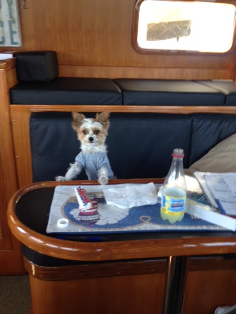
Keela wondering is she has returned to the warm beaches of Mexico

We finally left on 6/8/15 and still had a bumpy but OK ride to Campbell River.  

Vancouver to Nanaimo 6/2/15

Our stay at Royal Vancouver Yacht Club came to an end and we headed west to Nanamio on Vancouver Island.  Nanamio is a harbor town of about 80,000 people.  Its roots go back to early 1800's as a trading post and growth accelerated when coal was discovered.  Mining and other natural resources were commercialized by the ubiquitous Hudson Bay Company.

Leaving Vancouver harbor we enjoyed a 1-2 knot ebb current, light winds and peaceful crossing.  Plenty of commercial traffic ranging from container ships, cruise ships, bulk carriers and barges all competing for the advantage of the ebb flow.
Nanaimo anchorage near Mark's Bay 

 Just across from the main city harbor is a floating restaurant called the Dinghy Dock Pub.  Getting supplies to the pub and others on the nearby islands is routine work for the suppliers.  Here propane and beer make an interesting combination outbound for the pub.


The towns we have visited in Canada have all paid tribute to the past with monuments, reenactments and other interesting events.  Nanamio has restored the Baston that originally protected the harbor.  The sally ports housed cannons but were never fired in anger.  They have been recreated in detail using plans from British war ships and cast in England.  At noon the cannon is fired to remind everyone of the heritage they all share.  The salute fires blanks but the range is a 6" cannon ball half a mile.


Float plans land all day long just in front of the harbor.  Right at the edge of float plane operation is long dock for fishing and crabbing.  Since the locals were throwing crab pots off the dock decided to try our luck.  In less than an hour we landed 4  crabs.  Could of had a few more but the crabs managed to get the bait bag out thru one of the openings holding the gate open.  Saw two crabs escape as the pot was being brought up.  The learning continues and will attach the bait bag to prevent the clever crabs from escaping.  Dinner was excellent and have at least broke even on this crab trap.  More crabbing as we get further north.


Canada is full of parks and the views from most are just amazing.  This park is just across from main harbor and has camping facilities with dozens of sites.  Saw a few more of the black squirrels we saw in Vancouver but did not have a camera to record them.


The trees a bit larger than Keela is used to seeing........


  BOX SCORE 4 HOURS  18 Gallons 34 Miles (Ebb current of 2 kts almost all the way)